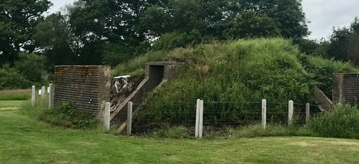
World War II Bunker
The bunker at Moors Valley was used during the Second World War to mimic the appearance of the nearby RAF airfields at Hurn and Ibsley.
Used as a bombing decoy between 1942 and 1944, it housed two generators to power a flare path of lights, protected by a blast wall.
Outside of open days, visitors can see the ‘telescope’ that can be found close to the park and forest and Crane Loop Trails which show the direction of the flare path.
Bunker Open Days
Although normally closed to the public, the bunker will be accessible on selected open days. A ‘telescope’ pointing in the direction of the flare path which replicates the view you would have seen from that point at night is located on the park and forest (yellow) waymarked walk / Crane Loop (pink) waymarked cycle trail and is available to use at any time throughout the year. Read more about bunker open days
Please note – access inside the bunker for mobility scooters is not possible due to space restrictions.
History
This Drem-Q type bunker, known as Q160b, housed two generators to power a flare path of lights installed to the south. By mimicking the appearance of a real airfield at night, the lights were designed to draw enemy bombers away from nearby RAF Ibsley and RAF Hurn during World War II. Decoys were also used to draw attention away from towns, cities, factories and oil installations. They were born through a collaboration between an Air Ministry team and Sound City Films at Shepperton Studios – an elaborate illusion employing special effects to trick the enemy.
The flare path was almost 1km long and made up of lights spaced approximately 100m apart. To prevent friendly aircraft from attempting to land on the non-existent runway, each end had a bar of hooded red lights, only visible at low level.
This bombing decoy was used between 1942 and 1944. Operators walked the flare path every evening at dusk to test the lights. The ‘Decoy Men’ were probably the only servicemen inviting the enemy to attack them – in order to save thousands of others. The two entrances to the decoy were protected by a blast wall but bunkers like this one would probably not survive a direct hit. More detailed information can be found in the following documents/websites:
- Original diagram of a single hooded flare path, photo of original document stored at the National Archives, Kew
- Extract from RAF Monograph, a 20-page extract from an original RAF Monograph – Decoy and Deception, produced by the Air Historical Branch
- Diagram of a Drem-Q shelter – based on Air Ministry drawing CTD 367/41
- Location of the flare path in the present landscape
- Geograph.org.uk website photographs of the bunker
- Instructions to operators from the National Records Office in Kew
- “One particularly terrifying night” air raid at Verwood
Acknowledgements
We are extremely grateful to the 3LX Community Fund, Verwood Town Council and Verwood Rotary for their contributions towards this project.
The project was largely driven by a dedicated group of volunteers who gave up their time to collate research as well as help the rangers to restore the bunker and consult on the interpretation panels. Huge thanks to Mike, Kevin and Karen, whose efforts have been instrumental throughout this project.
